Welcome to the South Eastern Council of Governments (SECOG) Regional Safety Action Plan project website, a central hub for learning about the effort to improve roadway safety and reduce serious and fatal crashes across the southeast South Dakota region.
This site will be updated regularly as the project moves forward, so community members, local leaders, and partners can stay informed and involved at every step.
How to Participate - Phase 2
Document Library
Final Plan
Appendices
-
 Appendix 1 and Table of ContentsPDF (323.13 KB)
 -
Appendix 2PDF (154.84 KB)
-
Appendix 3PDF (259.29 KB)
-
Appendix 4APDF (11.49 MB)
-
Appendix 4BPDF (3.78 MB)
-
Appendix 4CPDF (9.02 MB)
-
Appendix 4DPDF (9.51 MB)
-
Appendix 4EPDF (2.74 MB)
-
Appendix 5PDF (4.95 MB)
-
Appendix 6PDF (540.53 KB)
-
Appendix 7PDF (226.93 KB)
Safety Measure Activity
Q&A
Have a question or comment?
Let us know if you have any questions or comments on the information presented on this website.
To ask a question you must create an account or log in.
These are the people that are listening and responding to your questions.
Sam Trebilcock
Planner
{{question.description}}
Roadway Safety Concern Maps
View Roadway Safety Concerns on the Community Maps
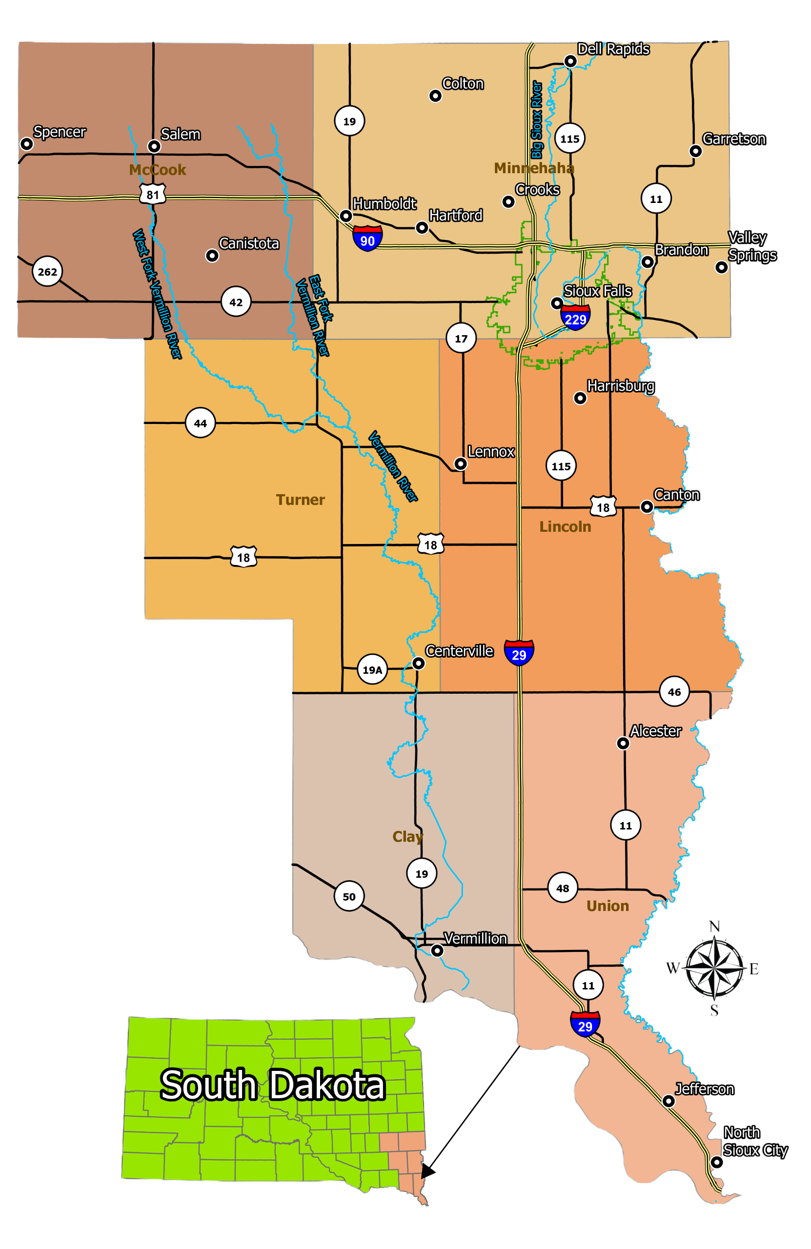
The map below shows the coverage area of this regional plan highlighting the communities impacted. Click on a red icon to view the community page.